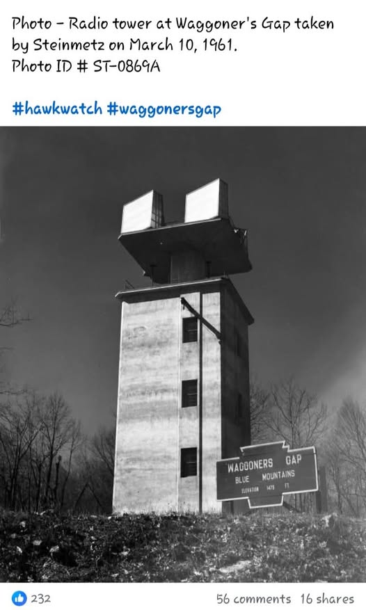
March 1961 photo by Steinmetz
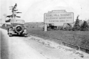
Typical of the Original (1920s-30s) version of the ridgetop Keystones. Photo From PennDot Collection.
Waggoner’s Gap sign on PA Route 74 at crest of Blue Mountain
March 1961 photo by Steinmetz
Typical of the Original (1920s-30s) version of the ridgetop Keystones. Photo From PennDot Collection.
Waggoner’s Gap sign on PA Route 74 at crest of Blue Mountain