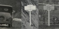
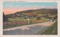
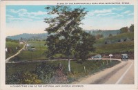
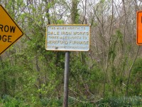
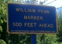
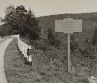
We are excited to present a variety of user-submited historical photos incorporating the Keystone Markers. As we receive them, we will include them here. The photographs below illustrate the variety and ubiquity of the Keystone Markers in the early part of the twentieth century on Pennsylvania highways.
Town Name Markers
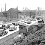
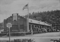
- This 1947 image showing one of Lemoyne’s Keystone Markers was used on the program cover for the 2011 Statewide Heritage Conference.
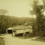
- Notice the Keystone Marker just to the left of the tree at the extreme left in this 9/28/1936 photo of the Bucknell Covered Bridge over Little Swatara Creek in Jonestown, Lebanon County. Submitted by Matt Hamel
- A rare view of a Philadelphia marker, of which only one is known to still exist. Duke University Libraries
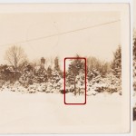
- This is a Wayne, PA, real photo postcard, postmarked 1944, depicting the “Five Points” intersection of Conestoga Road, Church Road, Iven Avenue and Aberdeen Avenue. Hidden within the snow-covered foliage is a keystone marker. This particular marker is somewhat notorious for its restoration and re-location to the center of town. The full story is in the article posted here. The location today is seen in this Google street view. The re-located sign is now in a prominent spot in the center of town, and it has become a well-recognized fixture. See it here. Courtesy of Greg Prichard
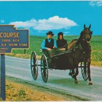
- The markers of some towns, such as Intercourse, were popular subjects for postcards over the years. (Courtesy of Greg Prichard)
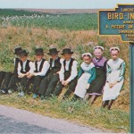
- A postcard showing the marker at Bird-In-Hand.
Waterway Markers
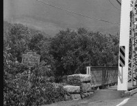
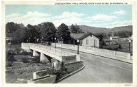
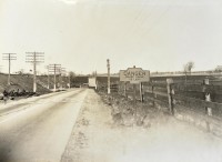
- Not only were small streams given Keystone Markers, but even Pennsylvania’s mightiest rivers received markers. Here is the Keystone Marker for the Susquehanna River (North Branch), at Bloomsburg. This is a section from a photograph of a bridge taken by the Historic American Engineering Record. Original image here.
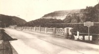
- Keystone Markers of every variety were a common sight along the Lincoln Highway. Today, much of the Lincoln Highway through Pennsylvania is known as US Route 30. Shown here is the Loyalhanna Creek Keystone Marker over the long bridge over the Loyalhanna Creek on the Lincoln Highway just west of Ligonier, Pennsylvania.
- One of the markers from Blossburg, Tioga County, is shown in its orginal location, near the end of South Williamson Road at Gulick and Main Streets. The notation in the Picasa site where this photo is from says “This is the bridge I remember growing up, without the lights. Note the two historical markers. The cement marker is still there. The metal one has been moved near the Main St bridge.” Relocation is one of the most common problems with exising keystone markers. Relocating them removed them from the context that gave them meaning.
- Marker for Ice Mine Cut from a postcard provided by John Glanfield.
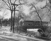
- This photograph, dated 1945, shows the famous Knox covered bridge at Yellow Springs Road in Valley Forge. The visible keystone marker identifies Valley Creek. (Radnor Historical Society)
- A waterway sign for Walnut Creek (left of the bridge) stands alongside a round, reflective “Narrow Bridge” sign. (Pennsylvania Department of Highways Collection, Pennsylvania State Archives: RG-12 OL 5-0569 box 10, #3044)
Directional Markers
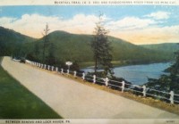
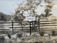
- A remarkably scenic photograph of a directional marker pointing the way to Monterey and Waynesboro. These markers are believe to have been painted black and white. (Pennsylvania Department of Highways Collection, Pennsylvania State Archives: RG-12 OL 5-0609 carton 6, #3153)
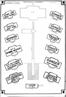
- This Pennsylvania Department of Highways Maintenance Standards page shows the many types of Keystone Markers as well as an optional directional sign “flag,” shown here on the post and below with “Lebanon, 15 mi.” We have not seen evidence that these directional flags were ever actually produced. (Pennsylvania Department of Highways Collection, Pennsylvania State Archives: RG-12 OL 5-0581 box 33, #1413)
- This 1942 photograph of downtown Lewisburg shows a directional keystone marker, naming four local towns and the distance to them. The towns and distances noted are as follows: Sunbury-10, Harrisburg-64, Mifflinburg-9, Bellefonte-54. (Photo courtesy of Matt Hamel)
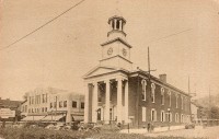
- A directional marker is visible on the left, in this view of the Mifflin County Courthouse in Lewistown.
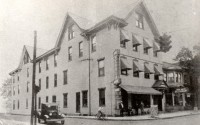
- Notice the directional Keystone Marker at the left near the automobile in this view of Muncy’s Hotel Stover. (Submitted by Matt Hamel)
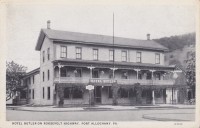
- A directional marker was found in front of the Hotel Butler in Port Alleghany. (Greg Prichard)
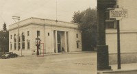
- Keystone Markers were used as directional signs, as this photo of the bank in downtown Wayne, ca. 1930, demonstrates. Right next to the clock is a directional Keystone Marker. Its paint scheme (blue and white? black and white?) and messages give some clues as to what these markers (which must have been all over the place) were like. Here’s what it says: 15 < Philadelphia Coatesville > 25 Lancaster > 51 Harrisburg > 87 (Radnor Historical Society)
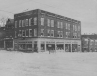
- This 1930s winter scene of the Fronefield Building in Wayne, Pa., shows two directional keystone markers. This is Wayne’s most prominent intersection, and the signs point to nearby towns: on the left sign (pointing east and west): Philadelphia, Coatesville, Lancaster, and Pittsburgh. On the right sign (pointing north and south): Newtown Square and Media (two more are illegible). (Radnor Historical Society)
- A directional marker at the intersection of Rt. 252 and Rt. 23, at the foot of the historic Washington Inn. This marker has the rare distinction of a “0” distance to Valley Forge.
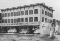
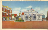
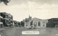
- A directional Keystone Marker can be seen in this postcard view of the Bank of Newberry in Williamsport. Submitted by Jim Carn
- Another view of the directional Keystone Marker in front of the Bank of Newberry in Williamsport. Submitted by Jim Carn
- This rural directional marker points the way to Pittsburgh and Apollo, among other towns.
Traffic and Facility Markers
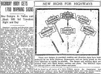
- This 1922 Philadelphia Inquirer article describes the beginning of Pennsylvania’s program to install traffic markers across the state.
- A top-mount marker at the State Fish Hatchery at Tionesta, on the Allegheny River. Similar top-mount markers were found at other state-run institutions such as nurseries and state colleges. From “My Pennsylvania: A Brief History of the Commonwealth’s Sixty-Seven Counties,” by Edward Martin, published 1946.
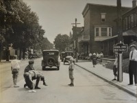
- Don’t be alarmed by this disturbing scene! This is one of a series of photographs produced by the Pennsylvania Department of Highways’ public relations office, demonstrating the vital need to obey the warnings displayed on signs such as Keystone Markers. (Pennsylvania Department of Highways Collection, Pennsylvania State Archives: RG-12 OL 5-0601 box 3, #1641)
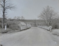
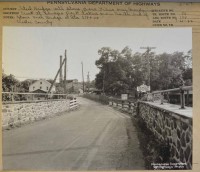
- This marker posted at a Chester County bridge near Lenape Park reads “Danger Narrow Bridge One Car Width.” (Pennsylvania Department of Highways Collection, Pennsylvania State Archives: RG-12 OL 5-0569 box 8, #6143)
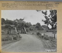
- A warning marker reading “Danger Narrow Bridge One Car Width” was posted in front of this iron truss bridge in Chester County. (Pennsylvania Department of Highways Collection, Pennsylvania State Archives: RG-12 OL 5-0569 box 8, #6130)
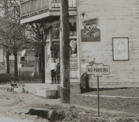
- This detail of a photograph showing a road in an unnamed Pennsylvania town includes a “No Parking” Keystone Marker, on an uncharacteristic round pole. (Pennsylvania Department of Highways Collection, Pennsylvania State Archives: RG-12 OL 5-0607 carton 5, #3033)
- A “Danger: Sharp Curve to Left” marker. (Pennsylvania Department of Highways Collection, Pennsylvania State Archives: RG-12 OL 5-0581 box 33, #3005)
- A “Warning: Curve to Left” marker. (Pennsylvania Department of Highways Collection, Pennsylvania State Archives: RG-12 OL 5-0607 carton 5, #2591)
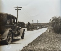
- An automobile approaches a “Warning: Curve to Left” marker. (Pennsylvania Department of Highways Collection, Pennsylvania State Archives: RG-12 OL 5-0607 carton 5, #2574)
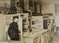
- This photograph appears to show a Pennsylvania Department of Highways display at a conference or convention. Many official state highway signs were on display, from “Stop” signs to Keystone Markers. (Pennsylvania Department of Highways Collection, Pennsylvania State Archives: RG-12 OL 5-0603 box 4, #2116)
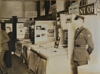
- This photograph appears to show a Pennsylvania Department of Highways display at a conference or convention. Many official state highway signs were on display, from “Stop” signs to Keystone Markers. (Pennsylvania Department of Highways Collection, Pennsylvania State Archives: RG-12 OL 5-0603 box 4, #2114)
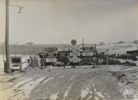
- This image likely shows a test in progress for the reflectivity and overall visibility of various Pennsylvania state highway signs, including various types of Keystone Markers. (Pennsylvania Department of Highways Collection, Pennsylvania State Archives: RG-12 OL 5-0603 box 4, #2074)
- This Keystone Marker told motorists “No Parking on This Side of Road.” (Pennsylvania Department of Highways Collection, Pennsylvania State Archives: RG-12 OL 5-0601 box 3, #1701)
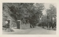
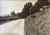
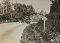
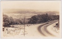
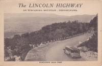
- The Lincoln Highway Digital Image Collection at the University of Michigan houses many wonderful photographs of the Lincoln Highway in Pennsylvania and other states. These images, mostly captured in the 1920s, show a number of keystone markers (mostly shown from behind). Shown are three of them. All of these markers appear to be “Warning” and “Danger” signs, rather than the better-known town name markers. These “Warning” markers appear to have been painted white or another light color, unlike the blue town markers. Some of these images are from 1924, approximately two years before the PA Dept. of Highways first made the town markers. From the Lincoln Highway Digital Image Collection
- Markers of all types were so prevalent on the Lincoln Highway, they can often be found in photographs of the highway.
- Markers of all types were so prevalent on the Lincoln Highway, they can often be found in photographs of the highway.
Large Markers
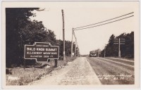
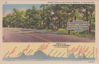
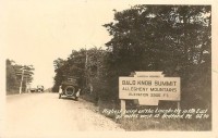
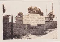
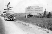
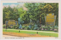
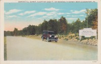
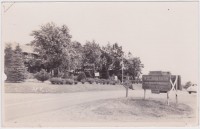
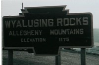
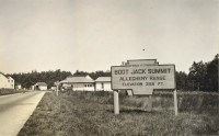
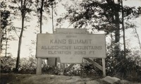
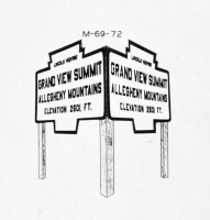
These large wooden signs in the shape of Keystone Markers were placed all along Pennsylvania’s highways at notable elevations. They are among the most photographed markers historically, as they were convenient for posing next to on long drives. None of these huge markers exist today, so these images are all that is left.
- Photo from an old postcard provided by Dan Graham
- The postcards of the large marker at Bald Knob Summit from different times show the two different paint schemes used by the Department of Highways at different periods.
- The postcards of the large marker at Bald Knob Summit from different times show the two different paint schemes used by the Department of Highways at different periods.
- The large marker at Chestnut Ridge.
- This photograph from the 1930s again demonstrates how familiar the keystone marker shape was in the Commonwealth from the 1910s until well after the Second World War. While this sign, announcing to motorists on the Lakes-to-Sea Highway that they had reached the Coal Hill Summit of the Allegheny Mountains, was much larger than the standard keystone marker, its shape was the same. Photo from the Fred Yenerall collection
- The large marker at Denton Hill was accompanied by another large keystone-shaped sign.
- The Denton Hill large marker in a (presumably) older paint scheme.
- Goetz Summit.
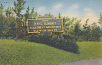
- This gigantic keystone marker-shaped, two-paneled sign announced to highway travelers that they had reached Kane Summit, the highest peak in Pennsylvania.
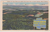
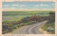
- This postcard shows Lookout Point Grand View and its large marker. The sign was cut from a separate photograph, and placed on top of the image of the view.
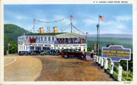
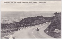
- A postcard image probably from the 1930s shows the keystone marker at Lookout Point, Grand View, in the Allegheny Mountains. The marker is along the old Lincoln Highway and adjacent to the unique S.S. Grand View Point Hotel, a hotel in the shape of a steam ship. Notice the keysone-shaped sign has a matching counterpart facing the other direction angled at 45 degrees.
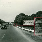
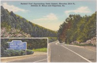
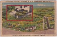
- This postcard shows the large marker at Ray’s Hill Summit, in the Blue Ridge Mountains. Visible next to this large marker is a “Dangerous Hill” marker. (Markers enlarged in red-bordered inset to show detail)
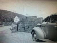
- Large Keystone Sign at Rays Hill with Dangerous Hill Keystone Marker next to it. Notice the reverse blue-letters-on-yellow-field scheme charactistic of directional signage at that time. A 1936 photograph provided by John Glanfield.
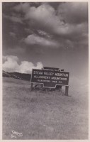
- The large marker at Steam Valley Mountain.
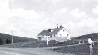
- This 1951 photograph from PennDOT’s Right of Way file shows the Turkey Ranch keystone-shaped marker near the summit of Steam Mountain on Route 15 north of Williamsport. The photograph dates from the time of an early highway widening project. Photograph courtesy of Matt Hamel
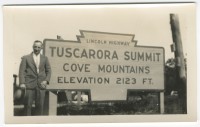
- A postcard showing the Tuscarora Summit large marker, along the Lincoln Highway.
- A snapshot of an unidentified tourist at the Tuscarora Summit large marker. (Radnor Historical Society)
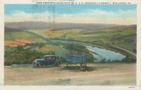
- The large marker at Wyalusing Rocks was accompanied by a standard “Dangerous Hill” marker.
- Seen a few years after the other Wyalusing Rocks image, the traffic marker next to the large marker has been removed and replaced by a diamond-shaped traffic sign.
- This view of the Wyalusing Rocks large sign appeared in a 1959 home movie, which can be viewed in its entirety here.
- Large Keystone Marker for Boot Jack Summit in the Allegheny Range along the Buffalo-Pittsburgh Highway. (Pennsylvania Department of Highways Collection, Pennsylvania State Archives: RG-12 OL 5-0581 box 33, #2227)
- Large Keystone Marker for Kane Summit in the Allegheny Mountains along the Buffalo-Pittsburgh Highway. (Pennsylvania Department of Highways Collection, Pennsylvania State Archives: RG-12 OL 5-0581 box 33, #2116)
- This Pennsylvania Department of Highways Maintenance Standards drawing shows one of the large Keystone Marker-shaped wooden signs. (Pennsylvania Department of Highways Collection, Pennsylvania State Archives: RG-12 OL 5-0581 box 33, #1415)
Historic Site Markers
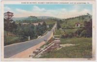
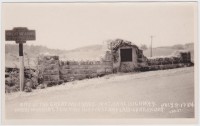
- A Keystone Marker was found on the roadside near the Braddock Monument east of Uniontown. It appears that the marker read “Major General Braddock’s Burial Place / July 13, 1755”.
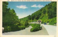
- Marker found at the site of Prince Gallitzin Spring between Duncanville and Cresson. Card found June 2014 by J. Graham
Variant Markers and Marker Relatives
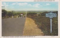
- This unusual “Longview” marker does not appear to have been a standard Keystone Marker, though its design was definitely inspired by the State-issued Keystone Markers.
- This marker, found at the site of the Great Meadows, was evidently handmade, and though it would seem to be unofficial, it is still labeled “State Highway Department.” Mounted on a wood post, this marker was probably erected next to the existing monument in order to attract motorists along the highway.
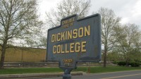
- While not a Keystone Marker, this marker provides further indication that state institutions of higher learning across the Commonwealth had markers. The location of this Dickinson College marker is on the southeast corner of W High Street and Belvedere Street in Carlisle, PA.
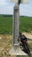
- This cast concrete marker is one of many which were installed along the Mason Dixon Line. Photo courtesy of bikewashington.org Marker information at www.hmbd.org
- Photo by Fitzhugh Clark.
- Installed by Historical Society of Berks County in the 1920s. Location: Barto, Pennsylvania. Photo by Fitzhugh Clark.
- While not a Keystone Marker, this marker is of a similar age and construction. Installed by Historical Society of Berks County. Location: Route 422 at roughly 40 deg 16 min 27.93 N latitude and 75 deg 46 min 54.51 W longitude. Photo courtesy of John Glanfield.
- This variant-shaped marker for McKean Forest has an unusual level of information. It is not known what the colors of this marker were, but the text surely did not contrast well with the background color. (Pennsylvania Department of Highways Collection, Pennsylvania State Archives: RG-12 OL 5-0601 box 3, #1813)
