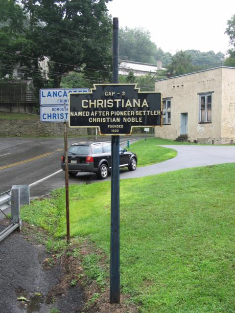
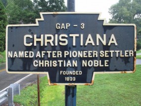
- COORDINATES: 39.948430, -75.991820
- COUNTY: Lancaster
- DISTANCE TO NEXT: Gap - 3 Note that a second marker noting Gap as the next town still stands here.
- EXPLANATION OF NAME: Named After Pioneer Settler Christian Noble. Note a second marker here refers to "Christiana" Noble.
- FOUNDED: 1833
- MANUFACTURER: Unknown, but likely Carlisle Foundry, as that company's name is on the other two markers here.
- STATUS: A piece of extra long pipe has been welded to the top of the post for reasons unknown.
2011 photo by C. Busch

2011 photo by C. Busch
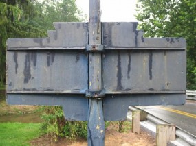
2011 photo by C. Busch
PA Route 372 – Bridge St. at East Branch Octorara Creek