- COORDINATES: 40.019333, -78.480835
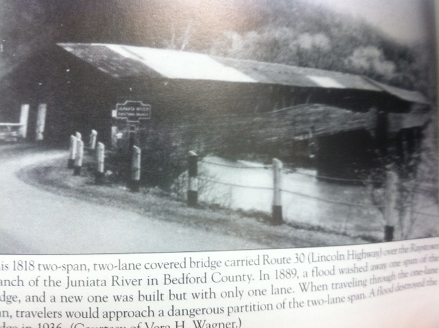
- COUNTY: Bedford - The location is the covered bridge that once carried the Lincoln Highway (U.S. Route 30) over the Juniata River at the town of Bedford.
- MANUFACTURER: Unknown
- STATUS: Long gone. Known only from the photo below, which is from a book titled "PA Covered Bridges" by Vera Wagner. The bridge was destroyed in a long ago flood. This marker may also have been the one moved to Manns Choice, where only a signless post remains today.

Photo from book, courtesy of JGl
Bedford at Juniata Crossing
Appears to be a double-sided marker on top mount post