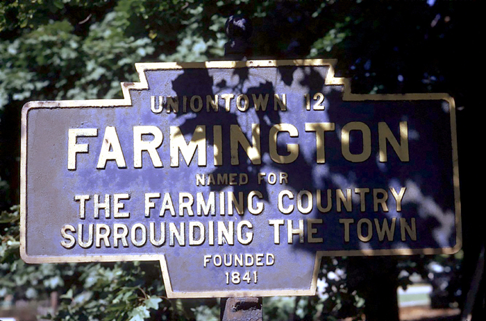
- COORDINATES: 39.806041, -79.562943 are approximate coordinates of where this marker was likely located.
- COUNTY: Fayette
- DISTANCE TO NEXT: Uniontown - 12
- EXPLANATION OF NAME: Named For the Farming Country Surrounding the Town
- FOUNDED: 1841
- MANUFACTURER: Unknown
- SHAPE: Standard 1-sided
- STATUS: Unknown. Believed to be long gone. Known only from this old photograph.
1974 photo by Fred Yenerall
U.S. Route 40 (National Road) east of town